Extract Urban Built-up Area (Urban Footprint) from SAR Data in the SNAP (Sentinel-1)

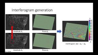
Urban Areas are continuously expanding and accelerating urbanization while detection these areas provide useful information and can be helpful for decision makers. Urban Builtup Area Extraction is one of the useful topics that can be used in many projects. in this video, we firstly show you how to preprocess Sentinel1 images Radiometrically & Geometrically such as Thermal Noise Removal, Calibration, Radiometric Terrain Flattening, Multilooking, Speckle reduction, Range doppler Terrain correction, etc. After preparing the Sentinel1 image, Builtup area can be detected more or less due to its high backscatter. Secondly, we classify the Sentinel1 image to properly extract Builtup areas. To classify the image we've utilized Random Forest Classification, but you can use other methods as well. All the processing have been performed in the SNAP software which is one of the powerful software in processing Sentinel images. Ask your questions in the comment if you want.
Subscribe to our channel and Like the video:
✅ / channel
_ _ _ _ _ _ _ _ _ _ _ _ _ _ _ _ _ _ _ _ _ _
Share the video with others:
✅ • Extract Urban Builtup Area (Urban Fo...
__________________________________________________________________
Timeline:
00:00 Introduction
00:27 Extract Urban Built Up Area Footprint from Sentinel1
01:34 Subset Sentinel1 Image
02:47 S1 Thermal Noise Removal
04:19 Calibration Sentinel1 Image
05:14 Radiometric Terrain Flattening
06:50 Multilooking
08:00 Single Product speckle Filter
09:12 Terrain Correction Range Doppler Terrain Correction SAR data
11:15 Classification SAR data in SNAP
14:50 Random Forest Classifier to Extract Urban Built Up Area from SAR data
__________________________________________________________________
Extract Urban Builtup Area (Urban Footprint) from SAR Data in the SNAP (Seintinel1)
Extract Urban Builtup Area from Sentinel1
Tags:
#Extract_Urban_Built_up_Area #Urban_Footprint #SAR_data #SNAP #Sentinel_1 #Sentinel #Extract_Built_up_Area #Extract_Urban_Built_up #Urban_Built_up_Area #RS #GIS #Tutorial_RS #Tutorial #GIS_Tutorial #SNAP_Tutorial #Sentinel_1_Tutorial #SAR_data_tutorial #How_to_Extract_Urban_Built_up_Area #How_to_Extract_Built_up_Area #How_to_Extract_Urban_Built_up #Sentinel_Application_platform #Copernicus #Radar #Radar_tutorial #Radar_processing #Radar_Image #Remote_sensing #Active_remote_sensing #esa_snap #urban_footprint #urban_mapping #urban_sprawl_mapping #urban_sprawl #mapping #geographic_information_system_Tutorial #geographic_information_system #Remote_sensing_Tutorial #digital_image_analysis #digital_image #image_analysis #Sentinel_image_analysis #RSandGIS RS & GIS #RSandGIS