Grow your YouTube views, likes and subscribers for free

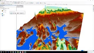
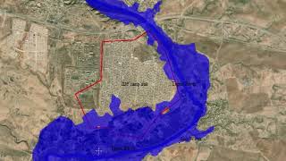
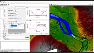
Flood Risk Simulation Map of an area using ArcGIS

How to prepare flood inundation simulation of an area using ArcMap and Arcscene. Hope this will make you understand potential flooding area identification within very short time using digital elevation model (DEM). I hope you will enjoy this video.
Tags: how to prepare flood map, flood risk map, flood inundation map, flood simulation, flood risk identification, how to prepare flood map in arcgis
#flood_map #flood_simulation #flood_risk_map #DEM #gisrssolution


Recommended