Flood Simulation and Modeling in ArcGIS

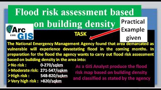
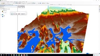
Flood Simulation and modeling is very good for assessing the impact of flood on public infrastructures. Flood Map shows the area which could get flooded if the water level rises to a particular elevation. This video shows you how to create flood simulation and modeling in ArcGIS.
For business and enquiries: WhatsApp+2347065365193 or Email: [email protected]
Subscribe for more videos:
/ @geojaygissolution4856
Related videos:
Morocco 2023 Earthquake Time Series Analysis in Google Earth: • Morocco 2023 Earthquake Time Series V...
Show DEM in 3D in ArcGIS: • Show DEM in 3D in ArcGIS
Extract water bodies from satellite images through NDWI: • Extract water bodies from satellite i...
Calculate NDVI from Landsat image in ArcGIS: • Calculate NDVI from Landsat image in ...
Landsat Timeline: Before downloading Landsat images, what you must know: • Landsat Timeline: Before downloading ...