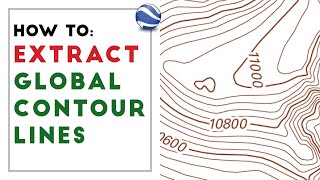
Generating Contour Lines from a DEM using ArcGIS Pro

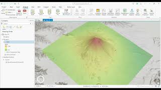
In this video, you will learn how to create a contour map by generating contour lines from a digital elevation model (DEM) using ArcGIS Pro software.
Contour lines are lines on a map that connects equal elevations. Contour lines can be quite helpful in understanding the topographical features of an area, especially when information is available only on a 2D plane in the form of a map. You will be able to deduce things like steepness of slopes, shapes of reaches and valleys as well as locations of hills and topographical depressions.
Contour lines play a crucial role in comprehending the elevation characteristics of your landscape or a specific geographical structure. This knowledge proves valuable in choosing an appropriate path for activities like hiking. Moreover, numerous other occupations rely on contour lines, including land surveyors, architects, foresters, engineers, miners, geologists, hunters, and many others.
In this video, we have used a digital elevation model to get started with the process of generating contours using ArcGIS Pro, and you would be able to download a DEM absolutely for free from the USGS EarthExplorer web portal if you are interested in trying out this process by yourselves.