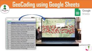
Geocode Address | Geocode by Awesome Tables | How to Get Latitude u0026 Longitude of Multiple Addresses

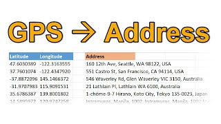
Geocoding is the process of transforming a description of a location—such as a pair of coordinates, an address, or a name of a place—to a location on the earth's surface. You can geocode by entering one location description at a time or by providing many of them at once in a table. The resulting locations are output as geographic features with attributes, which can be used for mapping or spatial analysis.
QGIS geocoding converts an address into geographic coordinates within the opensource GIS desktop application of QGIS. These coordinates can then be used to plot points on the map and do anything from building simple maps to calculating directions and distances between them.
FURTHER READING:
https://desktop.arcgis.com/en/arcmap/...
https://gisgeography.com/qgisgeocodi....
Geocode by Awesome Table
https://workspace.google.com/marketpl...