Geological symbols such as strike and dip in QGIS (Otago Geology)

This video shows one way to use custom symbols to plot geological measurements such as bedding, joints and lineations on a map using QGIS.
To learn how to create custom svg symbols see this video • Create custom geology symbols for QGI...
QGIS (a free and open source geographic information system) https://www.qgis.org/
The expression shown in the video (at 06:30) for the label offset is the following:
to_string((sin(radians("D_P_Azim")) * 2 )||','||(cos(radians( "D_P_Azim" )) * 2))
Where "D_P_Azim" is the field name and 2 is the offset factor (you can vary this to suit).
CHAPTERS
00:00 – Introduction
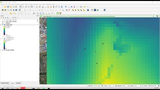
00:30 – Create new shapefile for data
01:49 – Add data to map
03:06 – Apply geological symbols from svg files
05:07 – Note about location of svg files
05:56 – Add dip / plunge labels
06:30 – Position labels with custom expression
07:38 – Wrap up