Georeferencing in 5 Minutes in ArcGIS | ArcMap

I am open to be hired for Geoinformatics and Spatial Analysis based Projects, so if you need support regarding your GIS and Remote Sensing based project, please contact me in the below provided Email Address or WhatsApp Number.
WhatsApp: +8801874646773
Email: [email protected]
_____________________________________________________________________
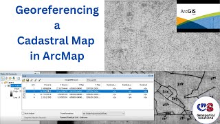
From Beginner to Master of Georeferencing in 5 minutes in ArcMap.
Georeferencing is a process used in geographic information systems (GIS) and cartography to assign realworld geographic coordinates (latitude and longitude) to spatial data that does not originally have such coordinates. It involves aligning or "referencing" data to specific locations on the Earth's surface, allowing it to be accurately positioned and integrated with other geographic information.
To digitize a Scanned Map or Raster Image in ArcMap, Georeferencing is the image or scanned map is a precondition.
In this video, the process is explained in the simplest way.
_____________________________________________________________________
UHI: • URBAN HEAT ISLAND (UHI) with ArcGIS f...
LST: • Land Surface Temperature (LST) from L...
Unsupervised Image Classification: • Image Classification in ArcGIS (Unsup...
Geodatabase Design: • Geodatabase Designing in ArcGIS for B...
Supervised Image Classification: • Image Classification in ArcGIS (Super...
Channel Intro: • GIS (Geographic Information Systems) ...
NDMI: • NDMI in ArcGIS | Moisture Index Map i...
Area from Classified Image: • Area Calculation from Image in ArcGIS...
NDVI: • NDVI in ArcGIS | Vegetation Map in Ar...
BSI (Bare Soil Index) Calculation: • Stream Order Map from DEM in Model Bu...
Area and Perimeter in ArcGIS: • Calculate Area and Perimeter of Polyg...
Digitizing in Google Earth Pro: • Digitizing in Google Earth Pro in 5 M...
Zonal Statistics in ArcGIS: • ZONAL STATISTICS in ArcGIS
Interpolation in ArcGIS: • INTERPOLATION by KRIGING in ArcGIS | ...
Digitizing in ArcGIS: • Zero to Hero of Digitizing in ArcMap ...
Georeferencing for Beginners: • Georeferencing Downloaded Image (Map)...
Georeferencing from Google Earth Image: • Georeference and Project Image in Arc...
Playlist of Beginner Guide to GIS: http://bit.ly/48Y0Gxw
Subscribe to the Channel: / @mdalamingeodu
_____________________________________________________________________
This playlist on the applications of ArcMap (ArcGIS Software) will enrich your basic and practical knowledge on Geographic Information Systems (GIS).
_____________________________________________________________________
Free Materials:
_____________________________________________________________________
I will sequentially upload videos on numerous ArcGIS applications so that you can master on Geospatial Analysis.
_____________________________________________________________________
Related Tags: #georeferencing #gis #arcgis #arcgistutorial #arcmap #projection #spatialdata #spatialanalysis #remotesensing #coordinatesystem #georeference #geography #englishtutorial #easytutorial #easytutorialsforbeginners #digitize #digitization #digitizing #GIS #GeographicInformationSystem Muhammad Al Amin #Geospatial Navigators