Grow your YouTube views, likes and subscribers for free

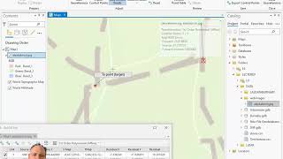
Georeferencing in ArcGIS Pro

https://gisgeography.com/georeferencing/
Georeferencing is the process of aligning an image to establish its spatial reference within a specific coordinate system.
The goal of georeferencing is to move, scale, rotate and transform any image to an existing map with known geographic locations and coordinates.
In this tutorial, I'm going to go through the process of georeferencing a map in ArcGIS Pro.


Recommended