Geosoft - 0 How to go about interpreting magnetic data

Steps:
1. Look at the regional magnetics and gravity. Mark terrain boundaries
How to make shape files of terrain boundaries:
• Geosoft How to create and export a ...
• Geosoft Importing shape file
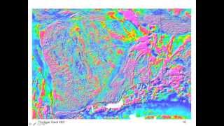
2. Map basement structures (thanks Abigail Ayikwei for this)
http://updates.geosoft.com/downloads/...
3. Calculate IGRF and remove from data
• Geosoft Calculating the IGRF values...
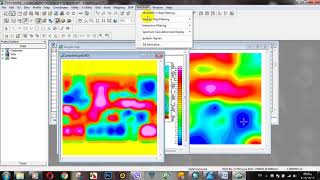
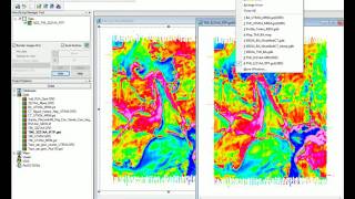
4. Filter the data (RTP, AS, LP, HP, Tilt derivative) Calculate RTP or RTE first and then apply filters
• Geosoft Calculating RTP, Horizontal...
• Geosoft 11 Image Processing of Magn...
5. Depth to basement estimates start with profiles instead of 2D
Free Euler deconvolution for profiles:
• Euler Software Potential field dept...
6. Profile modelling Have other data to constrain your profiles
• Geosoft Using GMSYS for 2D magnetic...


![[NEW] Structural Analysis of Aeromagnetic Data Using Oasis Montaj Software Replay](https://i.ytimg.com/vi/6GiPcG3Z1yQ/mqdefault.jpg)