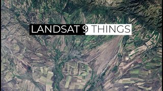
Getting Started with NASA Worldview

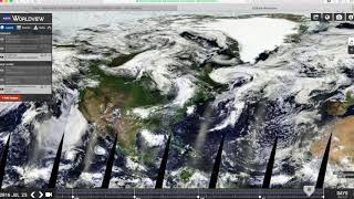
During this demonstration, we will introduce you to the NASA Earth Observing System Data and Information System (EOSDIS) Worldview imagery mapping and visualization application. This tool provides the capability to interactively browse over 900 global, fullresolution satellite imagery layers. Many of these layers are updated daily and are available within three hours of observation. Also available are geostationary imagery layers which are provided in tenminute increments for the last 30 days. These fulldisk hemispheric views allow for almost realtime viewing of changes occurring around most of the world essentially showing the entire Earth as it looks "right now". Worldview’s easytouse map interface lets you interactively explore NASA Earth science imagery to see hurricanes forming, wildfires spreading, icebergs drifting, and city lights illuminating.
Explore NASA Earth science data imagery using NASA Worldview:
https://worldview.earthdata.nasa.gov