GIS Spatial Analysis and Statistics

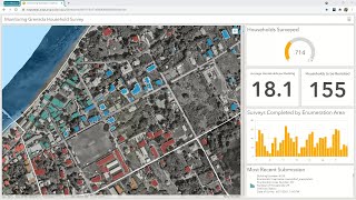
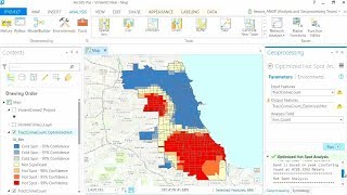
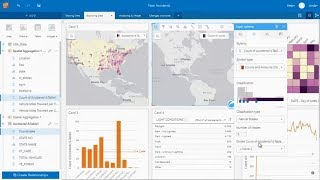
Location is the connective thread allowing us to uncover hidden patterns, discover trends in our data or improve predictive modeling. GIS is being used today by statisticians to visualize and explore data, conduct spatial analysis, including the integration of machine learning models, and in the area of big data analytics and data science.
In this webinar, we explore how you can use GIS to easily integrate location and spatial analysis in your workflows. Learn about:
Bringing location data into your analysis
Answering spatial questions
Creating sophisticated statistical and machine learning models
Modeling and scripting – automating and extending functionality
Follow us on Social Media!
Twitter: / esri
Facebook: / esrigis
LinkedIn: / esri
Instagram: / esrigram
The Science of Where: http://www.esri.com