Easy way to get 15 free YouTube views, likes and subscribers

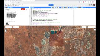
Google Earth Engine examples - creating a filtered composite
Guided tutorial showing how to use GEE example scripts to create a filtered composite image from a Landsat 7 and Landsat 8 collection. Image collections are filtered by date and by spatial location (polygon) and the median pixel value is computed and visualised.
Shaun R Levick
https://www.geospatialecology.com


Recommended