Google Earth Engine Web application for Water Quality Monitoring using Remote sensing techniques

Registration is open for 3 days of Online Training on Google Earth Engine for Air & Water Quality Monitoring using Remote sensing techniques
Class Start: 29th December
Admission Last Date: 20th December
Booking last Date: 16th December
Total Class: 3 days
Class Durations: 3 hours (Each day)
This online training program fee is 500 dollars but 1st 5 registered people get a 50% discount of only 250 dollars. Only one seat is available for getting this 50% discount. Take advantage of this discount and register very first!!!
You can make this payment from any country using western union or Money gram using the below information
Receiver Name:
First Name: Md.Mijanur
Last Name: Rahman
Country Name: Bangladesh
Address: Dhaka1212
Mobile number: +8801780942798
Or these is my bank account details
Bank Account Information:
• Bank Name: DUTCHBANGLA BANK LTD
• Account Number: 1081050058229
• SWIFT Code: DBBLBDDH
• Routing number: 090276349
• Branch Name: Shantinagar (Dhaka south)
• Account Holder Name: Md Mijanur Rahman
Country Name: Bangladesh
You can also make this payment directly in my Bank account.
After completing this payment send me the receipt then I'll add you to our online training WhatsApp group.
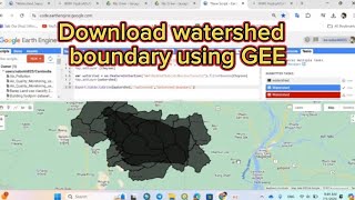
These classes will teach you all the necessary things to start using GEE for your remote sensing analysis. We mainly focus on these people who don't know any programming language and Earth Engine function. After completing this course, you can do any Remote sensing analysis very quickly and efficiently using the Google Earth Engine Platform. We cover LULC mapping, Air quality, Monitoring, Time series analysis, Calculating any Indices, Supervised Classification, Machine Learning Methods, and more.
Course Content for Air Quality Monitoring:
1) O3, NO2, SO2, HCHO, CHOCHO and aerosols , CO, CH4, and stratospheric O3 density Map using Google Earth Engine
2) How to make timeseries Chart
3) Download Air Quality parameters Time series data in CSV format using Google Earth Engine.
4) How to convert this unit mol/m2 to molecules/cm3
5) How to export this Map and use ArcMap
Course Content for Water Quality Monitoring:
1) NDTI: Normalized Difference Turbidity Index
2 )NDCI: Normalized Difference Chlorophyll Index
3 )NDWI: Normalized Difference Water Index
4 )AWEI: Automated Water Extraction Index
5 )TSS remote sensing Model
6)Turbidity remote sensing Model
7)Chlorophyll
8 )Time series Chart for TSS, Turbidity, and Chlorophyll
9 )Make the time series change Animation
Join Our Community:
Join our official YouTube Channel: / @gisrsinstitute
Join our official Facebook Page:
/ studyhackseducationcenter
Join the Telegram group: https://t.me/gisandremotesenginglearn...
#gis #remotesensing #googleearthengine #EarthEngine