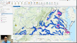
How to add a Digitize Google Earth Pro file into ArcGIS Pro
How to add a Digitize Google Earth Pro file into ArcGIS Pro
Join our telegram Group Remote Sensing & GIS Professionals: https://t.me/joinchat/UhUorR2yhloKeKP...
Any Help Contact
Mr.Vikas [email protected]
WhatsApp Number= +918421031398
WhatsApp Chat:https://wa.me/+918421031398
Geotech GIS Training institute is a prestigious remote sensing training institute in India. Our vision is to bring an opportunity to every aspirant who dreams of a successful career in remote sensing and GIS field.
We conduct the following courses:
Training Program Related to Project Work Duration 1 Month
Basics of Remote Sensing and GIS Duration 3 Months
Advance Diploma in Remote Sensing and GIS Duration 6 Months
PG Diploma in Remote Sensing and GIS Duration 1 Year
Master of Remote Sensing and GIS Duration: 2 Years
You May Like
Population Density Data: https://www.census2011.co.in/census/s...
Diva GIS Shapefile: https://www.divagis.org/gdata
RS & GIS QA15 Download readytouse contour lines from Open DEM & Generate DEM from Contour: • RS & GIS QA15 Download readytouse ...
Land Use Land Cover Mapping in QGIS: • Land Use Land Cove (LULC) Mapping usi...
How to Download Landsat 9 Data set from USGS Earth Explorer: • How to Download Landsat 9 Data set fr...
Download Rainfall data: • Download rainfall data from CHRS Data...
Google earth Playlist : • Google Earth Hands On
ArcGIS : • ARC GIS
QGIS: • QGIS Lesson
Tags,
BandComposite, RemoteSensing, SatelliteImagery, ImageProcessing, GIS, EarthObservation, SpatialAnalysis,GIS, ArcGISPro, GoogleEarthPro, Mapping, Geospatial, KMLImport, DataIntegration, SpatialAnalysis, GISTutorial, MapMaking