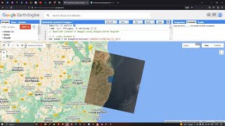
How to calculate Land Surface Temperature with Landsat 8 satellite images using Google Earth Engine

Registration is open for 7 days of Online private Training on Google Earth Engine (GEE) for Remote sensing Analysis for Beginners to Advanced level1
Take advantage of this discount and register very first!!!
For booking Your Seat Contact this WhatsApp Number: +8801780942798 or Email: [email protected]
These classes will teach you all the things you need to start using GEE for your remote sensing analysis. We mainly focus on these people who don't know any programming language and Earth Engine function. After completing this course, you are able to do any Remote sensing analysis very quickly and efficiently using the Google Earth Engine Platform. We cover LULC mapping, Air quality, Monitoring, Time series analysis, Calculating any Indices, Supervised Classification, Machine Learning Methods, and more.
Course Content:
1) Google Earth Engine: Introduction
2) Google Earth Engine 2: Filtering and Displaying Data
3) Google Earth Engine 3: Importing Raster and Vector Data
4) Google Earth Engine 4: Calculating with Images
5) Calculating NDVI, NDWI, and all indices.
6) Google Earth Engine 5: Introduction to Image Classification
7) Google Earth Engine 6: Landcover classification Map
Google Earth Engine 6: Exporting Raster and Vector Data
9) How to make a timeseries chart for NDVI, NDWI, and other Indices
10) Spectral indices and develop the skills for calculating any index (NDVI, NDWI, NDSI, MNDWI, MSAVI)
11) How to remove CLOUD Mask from satellite Images
12) Visualization (DEM) of Hill shade and Slope Map in GEE using NASA SRTM
13) Google Earth Engine: How to make an NDVI chart over a period of time
14) Air Quality Monitoring: Nitrogen Dioxide (mol/m^2) density using Google Earth Engine JavaScript API
15) Air Quality Monitoring: Sulphur Dioxide (mol/m^2) density using Google Earth Engine JavaScript API
16) How to Download Air Quality parameters Timeseries data in CSV format using Google Earth Engine
17) How to make Landcover Classifications Charts in Google Earth Engine | LULC Map Chart
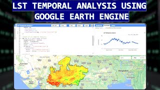
18) Land Surface temperature in GEE || Observe temporal patterns in LST using a time series Chart in GEE
19) How to Calculate Average, Maximum & Minimum NDVI in Google Earth Engine
20) Google Earth Engine: How to ADD A LEGEND, Title in your Map
21) Calculating LULC Map Area in Google Earth Engine
For booking Your Seat Contact this WhatsApp Number: +8801780942798 or Email: [email protected]
Take advantage of this discount and register very first!!!
There are already over 150+ students who have taken part in our training and courses and many are already developing their own codes and research with the GEE.
Join Our Community:
Join our official YouTube Channel: / @gisrsinstitute
Join our official Facebook Page: / studyhackseducationcenter
Join Telegram group:
https://t.me/gisandremotesenginglearn...
Join What's App Group: https://chat.whatsapp.com/DJyR6BjhnBa...
Join Skype Group: https://join.skype.com/ym0c1b7bjxHH/
Join our Facebook page: / studyhackseducationcenter
Join our Instagram: / study_hacks_geoscience_world
#gis #remotesensing #googleearthengine #EarthEngine