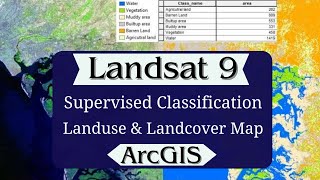
How to calculate snow covered area from Landsat 9 using ArcGIS | GIS Map | ArcGIS Tutorial

This video will help you to extract snow cover areas from Landsat 9 images using the ArcGIS raster calculator.
xxx
New ArcGIS learners follow below video sequence:
1 Introduction to ArcMap and its basic features: • Geoprocessing in ArcGIS | ArcGIS Basi...
2 How to create a shapefile in ArcMap: • GIS |How to make a shapefile in Arcma...
3 How to edit shapefile in ArcMap: • How to edit shapefile in Arcmap: ArcG...
4 How to add a field in ArcMap attribute table: • Adding field in shapefile attribute t...
5 How to calculate area in ArcMap: • How to calculate polygon area in ArcM...
6 Join and relates excel table with attribute table in Arcmap: • Join and relates excel table with att...
7 Geoprocessing in ArcGIS: • Geoprocessing in ArcGIS | ArcGIS Basi...
8 How to create a geodatabase in ArcGIS: • How to create geodatabase in ArcGIS
9 Thematic Maps Part 1: • Thematic Maps | Graduated Colors | Gr...
10 Thematic Maps Part 2: • Thematic Map | Multiple Attributes | ...
11 Thematic Maps Part 3: • Thematic Maps | Charts in ArcGIS | Ar...
12 How to Calculate Population Density: • Thematic Map | How to calculate popul...
13 How to create a map layout in ArcMap: • ArcGIS Map Layout : ArcGIS Basics
14 Labeling and annotation in ArcMap: • Labelling and annotation in ArcGIS | ...
15 Importing Excel coordinate to ArcGIS: • Importing excel coordinates to ArcGIS
16 How to export maps from ArcMap: • Export maps from arcmap: ArcGIS Basics
17 How to create buffers in ArcMap: • Export maps from arcmap: ArcGIS Basics
18 Georeferencing Raster with coordinate: • Georeferencing raster with coordinate...
19 Georeferencing Raster with shapefile: • Georeferencing raster data by shapefi...
20 Georeferencing raster to raster: • Raster to raster georeferencing: Geor...
21 Interpolation in ArcGIS: Kriging VS IDW: • Interpolation in ArcGIS: Kriging VS IDW
22 Clipping raster in ArcGIS: • Clipping Raster in ArcGIS : ArcGIS Ba...
23 Masking raster in ArcGIS: • Clipping raster by mask in ArcGIS
24 How to work on google earth and convert data into ArcGIS: • How to measure property area using Go...
25 How to create a data entry form in Microsoft Excel and display data on ArcGIS and Google Earth Pro.: • How to create data entry form in Micr...
26 How to extract elevation points, DEM, and Contours from Google Earth: • How to extract elevation points, DEM,...
27 How to download DEM data from earth explorer and mosaic in ArcGIS: • How to download and mosaic DEM in ArcGIS
28 How to create contours: • How to create contours in ArcGIS | Ar...
29 Join and relate the excel table with the attribute table: • Join and relates excel table with att...
30 How to calculate NDVI in ArcGIS using a raster calculator: • How to calculate NDVI in ArcGIS using...
31 Model Builder in ArcGIS: • Model builder in ArcGIS
xxx
#arcgis, #Indices, #easylearningwithahsan,
xxx
Channel Subscription: https://bit.ly/3wHJlWD