Free YouTube views likes and subscribers? Easily!

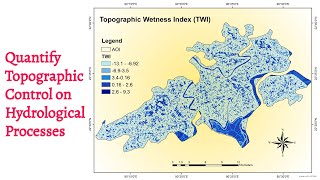
How to calculate Topographic wetness index using ArcGIS

The topographic wetness index (TWI), also known as the compound topographic index (CTI), is a steady state wetness index. It is commonly used to quantify topographic control on hydrological processes.


Recommended