How to change Coordinate System of shapefile in ArcGis and check the difference in Area and Length

In this tutorial, we'll explore how to change the coordinate system of a shapefile in ArcGIS and examine the resulting differences in area and length measurements. Understanding coordinate systems is crucial for accurate spatial analysis and mapping projects, and ArcGIS provides powerful tools to transform and manage coordinate systems seamlessly.
Subscribe to our channel: https://www.youtube.com/@geospatialin...
Have you ever wondered how to change the coordinate system of a shapefile in ArcGIS? Join us in this stepbystep tutorial as we dive into the world of coordinate systems and learn how to transform a shapefile's coordinate system in ArcGIS. We'll explore the importance of choosing the correct coordinate system for accurate spatial analysis and demonstrate how to check the current coordinate system of a shapefile.
By the end of this tutorial, you'll have a solid understanding of how to change the coordinate system of a shapefile in ArcGIS and assess the differences in area and length measurements resulting from the transformation. Mastering these skills will enable you to ensure the accuracy and integrity of your spatial analysis and mapping projects.
Related Videos:
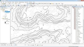
Create Digital Elevation Model , Contour and Slope in Arc GIS . FOR BEGINNERS
• Create Digital Elevation Model , Cont...
How to change projection from Everest1830 to WGS1984 |Datum Transformation in Arc GIS
• How to change projection from Everest...
Supervised Image Classification in ERDAS Imagine
• Supervised Image Classification in ER...
How to extract Study Area from Google Earth and export in ArcGIS !
• How to extract Study Area from Google...
#ArcGIS #CoordinateSystems #SpatialAnalysis