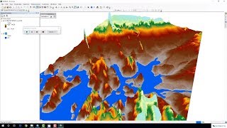
How to create 3D model in Arc Scene

Udemy course at ₹499 from (22 29 Oct 2022) Link: https://cutt.ly/qBMXjFu
Tutorial on creating 3D animated model in ArcScene.
******************************************************************
You can CHECK this OUT !!
BUY Domain at Cheap Price!! : https://cutt.ly/5CEuzSD
GIS Work|| Best laptop at Low cost!!
Acer Predator Helios: https://amzn.to/3MzpjWM
ASUS TUF Gaming: https://amzn.to/3CwUpti
Lenovo Legion: https://amzn.to/3g87HEW
MSI Stealth: https://amzn.to/3CX9qWH
MSI GV15: https://amzn.to/3EHtSfM
Acer Nitro: https://amzn.to/3CBJLSh
******************************************************************
Arcgis Tutorial: • Calculating Chlorophyll Index & Globa...
Qgis Tutorial: • Calculating SAVI MSAVI NDWI MNDWI I...
3D Electric Wire Calculation: • Calculating Electric Wire Length Cons...
Change Detection: • Hotspot / Kernel Density Analysis : C...
Download Free Shapefile : • Download GIS Shapefile Data ( Road, S...
Download Soil Organic Carbon, Evapotranspiration, Land cover, Precipitation Data: • How to Download Soil Organic Carbon E...
Human Influence Calculation: • Human Influence Calculation over Eco...
Lineaments Extraction and density Mapping: • Lineaments Extraction and density Ma...
World Soil Map Shapefile: • Download World Soil Map Shapefile
Hotspot / Kernel Density Analysis : • Hotspot / Kernel Density Analysis : C...
GIS Shapefile Data ( Road, Structure etc.) for Any Country: • Download GIS Shapefile Data ( Road, S...
Land Cover Change Detection in QGIS : • Land Cover Change Detection in QGIS P...
Soil Moisture Index and Land Surface Temperature Calculation: • Video
calculate normalized burn ratio (NBR): • How to calculate normalized burn rati...
Detail Watershed Delineation using DEM: • Detail Watershed Delineation using D...
Suitability Analysis Using Arcgis : Complete Project: • Suitability Analysis Using Arcgis : C...
Tags: how to create 3d model in arcgis, gis data to 3d model,how to make 3d landscape models, arcscene contour,create 3d line arcgis, how to make 3d map in arcgis,arc scene,arcscene 3d tutorial,arcscene tutorial,3d model in arcgis,fly around in arcscene,dem to 3d model,dem to 3d arcgis,dem to 3d terrain model in arcscene,3d arcgis,3d arcscene, digital elevation model,dem,modèle numérique de terrain,3d maps with arcgis and arcscene!,mouak said,image draped on a dem,esri (award winner),arcgis,gis,gis albania,map,inxhinieri gjeoinformatike,arcmap,arcscene,arcglobe,tin,3d,3d modeling,imazh satelitor,esri,arcgis desktop, arcgis desktop basic, analyse,online class, free online courses, remote sensing,online learning,geodatabase,gis application, esri maps,gis technology,