How to Create a Digital Elevation Model (DEM) Map using ArcMap - A Step-by-Step Guide

Creating a Digital Elevation Model (DEM) using ArcMap is a useful skill for anyone working with geospatial data and conducting terrain analysis. A DEM is a representation of the topography of a region in a digital format, and it can be used to create elevation profiles, perform slope analysis, and generate hillshade and aspect maps. ArcMap is a popular GIS software that provides the tools necessary for creating a DEM from elevation data sources such as LiDAR or contour lines. In this stepbystep guide, we will cover the process of creating a DEM using ArcMap, from importing the elevation data to generating a 3D visualization of the terrain. By following this guide, you will gain a better understanding of how to manipulate and analyze elevation data in ArcMap, and you will be able to apply these skills to a variety of geospatial projects.
Get the Best Price at Indiamart
Digital Terrain Modelling:https://dir.indiamart.com/impcat/digi...
3D Elevation Service:https://dir.indiamart.com/impcat/3de...
Geological Models:https://dir.indiamart.com/impcat/geol...
▶ Useful ArcMap Tutorial For You:
How to make Watershed Delineation: • Hydrological Project How to Make Wa...
How to Create Indian River Flow Direction: • Comprehensive Guide to Watershed Deli...
How to Create Enhance Vegetation Index: • Maximizing Greenery: Improving Vegeta...
How to Exporting Georeference Data: • Exporting Georeferenced Data in ArcM...
How to make a smart city: • Creating a Smart City Project with Ci...
How to make Kriging model: • Creating Accurate Kriging Interpolati...
How to use DEM data for Watershed Basin: • How to Perform Hydrology Analysis in ...
How to Extract Waterbodies: • Extracting Water Bodies: A StepbySt...
How to Calculate the Chlorophyll Content of the Leaves: • Measuring Chlorophyll Content of Leav...
How to Integrated Watershed Management: • Implementing Integrated Watershed Man...
How to creating grid index features: • Creating Grid Index Features in ArcMa...
How to create Ferrous Minerals Map: • Creating a Ferrous Minerals Map Using...
How to make Kriging Geo statistical Map: • Creating Accurate Spatial Maps with K...
How to export raster data in Image (JPEG) format: • Exporting Raster Data in JPEG Format ...
How to use ArcGIS Server: • Video
How to Soil Adjusted Vegetation Index: • Calculating Soil Adjusted Vegetation ...
How to Global Environmental Monitoring Index: • Creating a Global Environmental Monit...
How to Kriging Method: • Creating an Ordinary Kriging Interpol...
How to create Contours: • Creating Contour Maps using DEM Data ...
How to view River stream: • A Guide How to Creating 3D Layers in...
How to make vector data: • StepbyStep Tutorial: Creating Point...
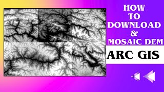
How to mosaic raster data: • Mosaic of Landsat 8 data in ArcGIS ||...
How to view 3D Surface: • Unlocking the Power of 3D Spatial Ana...
How to make Study: • Creating a Study Area Map with ArcMap...
How to download Any Country Shapefile: • StepbyStep Guide: How to Downloadin...
How to NDWI: • Mastering NDWI Mapping in ArcGIS: A C...
How to SoilAdjusted Vegetation Index: • A Comprehensive Guide to Calculating ...
How to Integrated Watershed Management: • Step by Step Guide Watershed Manageme...
How to make Iron Oxide map: • Creating an Iron Oxide (IO) Geologica...
How to calculate shape geometry: • A Comprehensive Guide to Calculating ...
How to interlinking review for DroughtHit parts: • Interlinking Rivers to Alleviate Drou...
How to find river stream: • How to find river stream using ArcMap...
How to Composite Bands: • Compositing Bands in ArcMap: A Stepb...
How to extract water river stream: • A StepbyStep Guide to Extracting Ri...
How to make LULC: • Land Use/Land Cover Classification Us...
How to create DEM: • How to Create a Digital Elevation Mod...
How to view study Area in Grid Index Features: • Creating Grid Index Features to View ...
How to make Digital Elevation Model (DEM) Indian continental: • Creating a Digital Elevation Model of...
How to make NDVI map: • Creating an NDVI Map Using ArcGIS: A ...
How to make Contour Lines with Graph and Table result: • Creating Contour Lines with Graph and...
How to view hilly region: • Visualizing Hilly Regions in ArcMap: ...
How to make Chlorophyll Index map: • Mastering Remote Sensing: How to Crea...
FOLLOW ME ON :
▶ YouTube Channel: @doitnew
▶ YouTube (My 2nd Channel): / @jaypalsingvlog
Instagram: / drjaypalsing
Facebook / kaytejaypalsing
Join as Member:
♦ Email: [email protected]
+918888880624
Share, Support, Subscribe!!!
Youtube: http://www.youtube.com/c/DoITNew?sub_...
#DigitalElevationModel #DEM #arcmap #arcgis #GIS #arcgis