Easy way to get 15 free YouTube views, likes and subscribers

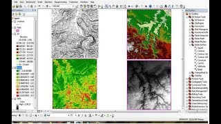
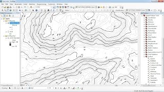
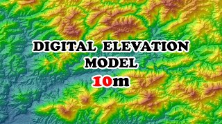
How to Create Contours and hillshade from DEM data || Generate Contour and Hillshade in ArcGIS

How to Create Contours and hillshade from DEM data || Generate Contour and Hillshade in ArcGIS
For more tutorial click on the links below:
• Land use/land cover classification in ArcGIS: • Supervised Classification of LANDSAT ...
• Supervised image classification: / watchv=ilt7vs7rshk&t=943s
• How to download satellite imagery: • How to Download Satellite Imagery || ...
• Digitization in ArcGIS: • How to digitize in ArcGIS || Digitiza...
• Georeferencing in ArcGIS: • Georeferencing in ArcGIS || How to Ge...
• Slope and Aspect Map: • Slope and Slope Aspect Map in GIS || ...


Recommended