How to create New Shapefile in ArcGIS ||ArcMap 10.8||

ថ្ងៃនេះយើងរៀនអំពីរបៀបបង្កើត Shapefile
យើងអាចបង្កើត Shapefile ថ្មីបានដោយប្រើ ArcCatalog ឬ Catalog Window ឬក៏ប្រើ Create Feature Class Tool។ នៅពេលយើងបង្កើត Shapefile ថ្មី យើងត្រូវកំណត់ប្រភេទនៃ Feature ដែលវានឹងផ្ទុក មិនថាលក្ខណៈទាំងនោះនឹងបង្ហាញផ្លូវ (mvalues) ឬក៏ threedimension (zvalues) ។
លក្ខណៈទាំងអស់នេះ មិនអាចកែបានទេ នៅពេលដែល Shapefile ត្រូវបានបង្កើត។ យើងអាចជ្រើសរើស ប្រព័ន្ធកូអរដោនេរសម្រាប់ shapefile អោយហើយតែម្តង ឬក៏ចាំបង្កើតហើយ ចាំជ្រើសអោយវាក៏បាន។ តែបើយើងចាំជ្រើសពេលក្រោយ វានឹងកំណត់ប្រព័ន្ធកូអរដោនៃShapefile នោះថា មិនស្គាល់(Unknown)។
សម្រាប់ការកំណត់ Attribute របស់ Shapefile ថ្មីគឺនៅដាច់ដោយឡែកពីការបង្កើត Shapefile ខ្លួនវា។
ដោយសារតែវាត្រូវតែផ្ទុកយ៉ាងហោចណាស់ Field មួយ ទើប ArcCatalog បញ្ចូល Default Column មួយទៅក្នុង Shapefile នោះ នៅពេលវាត្រូវបានបង្កើតឡើង។ បន្ទាប់មកទើបយើង អាចបង្កើតField អ្វីមួយដែលយើងចង់បានតាមក្រោយ ហើយលុបនូវ Field ណាដែលមិនត្រូវការចោល។
ដើម្បីបង្កើត Shapefile យើងត្រូវ៖
I. ជ្រើសរើសFolder ណាមួយដែលអ្នកត្រូវដាក់ទិន្នន័យទៅក្នុងនោះ ដោយប្រើ Folder Connection ក្នុង Catalog Tree
II. Right click on Folder ហើយយកពាក្យ New បន្ទាប់មក យកពាក្យ Shapefile
III. ផ្ទាំងមួយនឹងលោតឡើង បន្ទាប់មកដាក់ឈ្មោះអោយ Shapefile នោះ
IV. បន្ទាប់មកត្រូវ Click Feature Type ហើយជ្រើសរើសនូវ ប្រភេទ Geometry Feature ដែលអ្នកចង់បង្កើត
V. កំណត់ Coordinate System ដោយចុចពាក្យ Edit ហើយជ្រើសរើស ប្រព័ន្ធកូអរដោនេរមួយដែលអ្នកត្រូវការ (អ្នកអាចជ្រើសរើសពេលក្រោយក៏បានដែរ)
VI. ប្រសិនបើ Shapefile អ្នកជា ផ្លូវ គូស គ្រីស លើ Coordinates will contain M Values
VII. ប្រសិនបើ Shapefile អ្នកជាលក្ខណៈ 3D គ្រីស លើ Coordinates will contain Z Values
VIII. បន្ទាប់មកចុច Ok
បន្ទាប់មក Shapefile ថ្មីមួយនឹងលោតឡើងនៅក្នុង Table of Contents ហើយ អ្នកអាចចាប់ផ្តើសគូសវាបាន ដោយប្រើ Editor Tool។
Just drop your questions in the comment section if you have any problems.
Subscribe for more.
Sound: • Relaxing Sleep Music Peaceful Piano...
You can find more video that i create below:
1.How to divide land into proportional plots by using Parcel Farbric Tool in ArcMap ||speak Khmer||
• How to divide land into proportional ...
2.How to mosaic Raster Image in ArcGIS |ArcMap10.8|
• How to mosaic Raster Image in ArcGIS ...
3.Download High resolution image from Google Satellite by by Universal Map downloader
• How to download very highresolution ...
4. how to download High Resolution image from Google Satellite
• how to download High Resolution image...
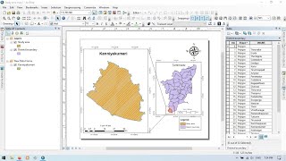
5. Create a Simple Map in ArcMap [Detail tutorial] [Speak Khmer]
• Create a Simple Map in ArcMap [Detail...
6.Create Map in ArcGIS Pro 2.6 ||Speak Khmer|| [Khmer GIS Academy]
• How to Create Map in ArcGIS Pro 2.6 ...
7. Create Simple Land Plot from Survey Data in ArcMap [Speak Khmer] Khmer GIS Academy
• Create Simple Land Plot from Survey D...
8. Composite Band of LandSat image and Mosaic Raster Data using Model Builder
• Composite Band of LandSat image and M...
9. Create Land Cover type using Google Earth Image
• Video
10. Georeferencing Google Earth Image and Digitization in ArcGIS
• Georeferencing Google Earth Image and...
11. Join and Relate, tool for attribute table in ArcGIS
• Join and Relate | How to join and rel...
12. Use Model builder to do more IDW process
• How to use Model builder to iterate m...
13. Interpolation find missing data using IDW tool in ArcGIS [Speak Khmer] Khmer GIS Academy
• How to find missing rainfall data usi...
14. Create Contour line using Elevation Data from Google Earth [Speak Khmer]
• How to create Contour line using Elev...
15. Get Elevation data from Google Earth [Part 1] [Speak Khmer] Khmer GIS Academy
• How to derive elevation data from Goo...
16. Convert kml or kmz (google earth pro) to Shapefile using ArcGIS (Speak Khmer) Khmer GIS Academy
• How to convert kml or kmz (google ear...
17. Using ArcGIS and Google Earth Create .kml or .kmz file (Speak khmer) Khmer GIS Academy [Part 1]
• Create .kml or .kmz file in Google Ea...
18. Create Point Shapefile derived from Google Map in ArcGIS without using Excel (Speak Khmer)
• How to Create Point Shapefile from Go...
19. Changing Projected Coordinate System in ArcGIS [Speak Khmer] Khmer GIS Academy
• How to change Projected Coordinate Sy...
20. Shapefile projection in ArcGIS [Speak Khmer] Khmer GIS Academy
• How to project shapefile in ArcGIS [S...
21. Create Topology for Shapefile check the error of the shapefile [Speak Khmer] Khmer GIS Academy
• Create Topology for Shapefile check...
22. Create a Sample Map in ArcGIS [Part 2] (Speak Khmer) Khmer GIS Academy
• Create a Sample Map in ArcGIS [Part 2...
23. Create a Sample Map in ArcGIS [Part 1] (Speak Khmer) Khmer GIS Academy
• How to create a Map in ArcGIS [Part 1...
24. ArcGIS Apply Geoprocessing Clipping Tool to Model Builder [Speak Khmer] Khmer GIS Academy
• ArcGIS Apply Geoprocessing Clipping...
25. ArcToolbox Extract Toolset explanation and practice [Speak Khmer] Khmer GIS Academy
• How to Split/Seperate the Shapefile t...
26. Geoprocessing Tool Clip and Merge in ArcGIS [Speak Khmer] Khmer GIS Academy
• How to Clip and Merge Shapefile in Ar...
27. Understand about the Attribute Table of a Shapefile [Speak Khmer] Khmer GIS Academy
• Understand about the Attribute Table ...
![Create a Simple Map in ArcMap [Detail tutorial] [Speak Khmer]](https://i.ytimg.com/vi/REwD1SQv2n4/mqdefault.jpg)