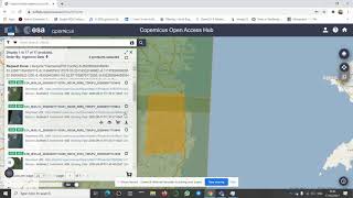
How to Download Altimetry Satellite Data from Hydrosat Stuttgart

Altimetry data is crucial for understanding ocean currents, sea level rise, and ocean circulation patterns. Hydrosat Stuttgart is a leading provider of satellitebased environmental data, including altimetry data.
. . . . . . . . .
Overall, downloading altimetry satellite data from Hydrosat Stuttgart is a straightforward process that can provide valuable insights into ocean dynamics and environmental changes. With this stepbystep guide, you will be able to easily access and download altimetry data from Hydrosat Stuttgart.
________________
Check it out:
Like & Share the video with others:
✅ • How to Download Altimetry Satellite D...
_ _ _ _ _ _ _ _ _ _ _ _ _
Subscribe to our channel :
✅ / @rsgis6997
=========================================================