How to download and import shapefile/vector GIS Data for any country – Free online sources

For the most part. The #maps you see online are raster images, is it possible to download vector data online? This video will show you how to get #FreeGISData
I’ll give you direct links to websites where you can download country #shapefiles, the files will feature:
1. country boundaries
2. state boundaries and
3. local government/county boundaries.
_________________________________________
Here are links to websites where you can directly download country shapefiles for free!!
1. https://www.divagis.org/gdata
2. https://www.igismap.com/downloadworl...
This video focuses on the first link.
_________________________________________
#GISdata can be downloaded by simply choosing your country of choice, and setting the download subject. This can be #AdministrativeBoundaries, water bodies, road networks, etc.
This video also shows you:
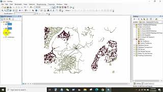
1. How to import #shapefiles to #QGIS using the browse panel.
2. How to determine map labels, and how to edit labels as related to each map.
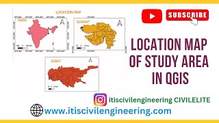
3. How to edit these maps if you intend to use them for #StudyAreaMapping.
_________________________________________
I’m sure you’d find this video helpful, so don’t fail to like and subscribe to my channel, #SpatialDataHub. Turn on post notifications to get notified when I drop more valuable content for your benefit. If I missed anything or you’re finding it difficult getting some things done, drop a comment below and I’d get to it ASAP.
_________________________________________
You can reach out to me for gigs (Technical Writing and GIS Analysis) and video suggestions using the links in the About section of this channel


![How to Copy Any Website With a Click For Free, Edit & Make It Live [NEW]⚡](https://i.ytimg.com/vi/GkcnlFc7IMk/mqdefault.jpg)