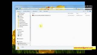
How To Download Landsat 8 Images From USGS EarthExplorer For Free

You will learn how to download landsat8 images from USGS for free in this video. I hope this video will help you to enhance your knowledge in GIS and Remote Sensing even more. To assess landcover changes, landuse changes, vegetation changes, and Land Surface Temperature (LST) Landsat images are very essential and this video will help you to download the images for free. Through this video you will easily be able to download Landsat 8 images from USGS Earth Explorer website yourself.
Link: https://www.usgs.gov/landsatmissions...
Landsat 8 (formerly the Landsat Data Continuity Mission, or LDCM) was launched on an AtlasV rocket from Vandenberg Air Force Base, California on February 11, 2013. The satellite carries the Operational Land Imager (OLI) and the Thermal Infrared Sensor (TIRS) instruments. The OLI measures in the visible, near infrared, and shortwave infrared portions (VNIR, NIR, and SWIR) of the spectrum. The TIRS measures land surface temperature in two thermal bands with a new technology that applies quantum physics to detect heat. Landsat 8 images have 15meter panchromatic and 30meter multispectral spatial resolutions along a 185 km (115 mi) swath. Landsat 8 provides continuity with the more than 40year long Landsat land imaging data set. In addition to widespread routine use for land use planning and monitoring on regional to local scales, support of disaster response and evaluations, and water use monitoring, Landsat 8 measurements directly serve NASA research in the focus areas of climate, carbon cycle, ecosystems, water cycle, biogeochemistry, and Earth surface/interior.
Unprecedented changes in land cover and use are having profound consequences for weather and climate change, ecosystem function and services, carbon cycling and sequestration, resource management, the national and global economy, human health, and society. The Landsat data series, begun in 1972, is the longest continuous record of changes in Earth’s surface as seen from space and the only satellite system designed and operated to repeatedly observe the global land surface at moderate resolution. Freely available Landsat data provide a unique resource for people who work in agriculture, geology, forestry, regional planning, education, mapping, and global change research.
For more videos related to GIS, Remote Sensing, Geoinformation Science and Climate change please watch videos of @EARTHGISensing . @EARTHGISensing will help you throughout your journey to learn all the tools and techniques of remote sensing and GIS. Please do not forget to like, comment and subscribe to the channel.
#satelliteimagesdownload #remotesensing #landsat #data #download #satelliteimages #downloadlandsat8 #earthexplorer #landsatdata #usgsearthexplorer