How To Download Sentinel-3 Images from Copernicus Open Access Hub

You will learn how to download sentinel3 images from Copernicus for free in this video. I hope this video will help you to enhance your knowledge in GIS and Remote Sensing even more. To assess Land Surface Temperature (LST) the Sentinel3 images are very essential and this video will help you to download the images for free.
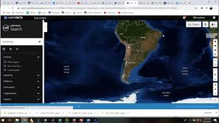
Link: https://sentinels.copernicus.eu/web/s...
SENTINEL3 is a low Earthorbit moderate size satellite compatible with small launchers including VEGA and ROCKOT. The main objective of the Sentinel3 mission is to measure sea surface topography, sea and land surface temperature, and ocean and land surface colour with high accuracy and reliability to support ocean forecasting systems, environmental monitoring and climate monitoring.
The Land Surface Temperature (LST) is a measure of how hot or cold the ‘surface’ of the Earth would feel to the touch. It is the mean radiative temperature of all objects comprising the surface, as measured by groundbased, airborne, and spaceborne remote sensing instruments. The constituents of the Earth’s surface (e.g. soil, vegetation, water, snow) vary from location to location. For each constituent, the LST is related to the points of maximum emission of electromagnetic radiation. Examples are bare soil and thick forest canopy which represent clear cases of this.
For more videos related to GIS, Remote Sensing, Geoinformation Science and Climate change please watch videos of @EARTHGISensing. Please do not forget to like, comment and subscribe to @EARTHGISensing .
#downloadsatelliteimages #downloadsentinel3 #sentineldata #remotesensing #sentinel3 #satelliteimages #sentinel #data #download #sentineldata
#copernicus #openaccess #copernicusopenaccesshub #downloadsentinelimages