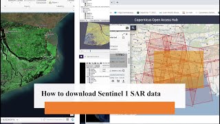
How to download Sentinel-1 images

In this tutorial, we will show you how to download Sentinel1 images from the European Space Agency's (ESA) data hub. Sentinel1 is a radar satellite mission that provides continuous allweather, dayandnight imaging of Earth's surface. The data can be used for a variety of applications, including monitoring sea ice, mapping land use and land cover changes, and detecting natural disasters. We will guide you through the process of selecting the area of interest, searching for available images, and downloading the data in different formats. Whether you are a researcher, scientist, or just curious about satellite imagery, this tutorial will help you get started with Sentinel1 data.
__________
Check it out:
Like & Share the video with others:
✅ • How to download Sentinel1 images
_ _ _ _ _ _ _ _ _ _ _ _ _ _ _ _ _ _ _ _ _ _
Subscribe to our channel :
✅ / @rsgis6997
=========================================================
#gis #remotesensing #arcgis #SNAP #Sentinel1