How to Extract Elevation Values from DEM using ArcGIS Pro
How to extract Elevation Values from DEM using ArcGIS Pro
The applications of elevation data extend to various other fields as well Accurate elevation information is fundamental for understanding and interacting with the natural and built environment.
The elevation of a geographic location is its height above or below a fixed reference point, most commonly a reference geoid, a mathematical model of the Earth's sea level as an equipotential gravitational surface (see Geodetic datum § Vertical datum).
Join our telegram Group Remote Sensing & GIS Professionals: https://t.me/joinchat/UhUorR2yhloKeKP...
Any Help Contact
Mr.Vikas [email protected]
WhatsApp Number= +918421031398
WhatsApp Chat:https://wa.me/+918421031398
Geotech GIS Training institute is a prestigious remote sensing training institute in India. Our vision is to bring an opportunity to every aspirant who dreams of a successful career in remote sensing and GIS field.
We conduct the following courses:
Training Program Related to Project Work Duration 1 Month
Basics of Remote Sensing and GIS Duration 3 Months
Advance Diploma in Remote Sensing and GIS Duration 6 Months
PG Diploma in Remote Sensing and GIS Duration 1 Year
Master of Remote Sensing and GIS Duration: 2 Years
You May Like
Population Density Data: https://www.census2011.co.in/census/s...
Diva GIS Shapefile: https://www.divagis.org/gdata
RS & GIS QA15 Download readytouse contour lines from Open DEM & Generate DEM from Contour: • RS & GIS QA15 Download readytouse ...
Land Use Land Cover Mapping in QGIS: • Land Use Land Cove (LULC) Mapping usi...
How to Download Landsat 9 Data set from USGS earth Explorer: • How to Download Landsat 9 Data set fr...
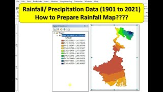
Download Rainfall data: • Download rainfall data from CHRS Data...
Download SOI Toposheet : • New Survey of India Website to Downlo...
Google earth Playlist : • Google Earth Hands On
ArcGIS : • ARC GIS
QGIS: • QGIS Lesson
DEM data utilization, ArcGIS Pro tutorial, elevation value utilization, geospatial analysis techniques, GIS enthusiasts, ArcGIS Pro tutorial, DEM data exploration, geospatial analysis, elevation value insights