Grow your YouTube views, likes and subscribers for free

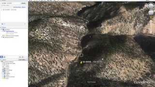
How to Generate DEMs and KMZ Hillshades on OpenTopography | Tutorial
Demonstration of how to produce digital elevation models (DEMs) and hillshade in KMZ and other formats using highresolution topography lidar data on OpenTopography.
https://opentopography.org/ | OpenTopography facilitates community access to highresolution, Earth scienceoriented topography data and related tools and resources


Recommended