How to import .gpx data data in ArcGis/GPS data add on arc Map.

#Import#GPS#GPX#ArcMap#ArcGis#Add
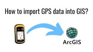
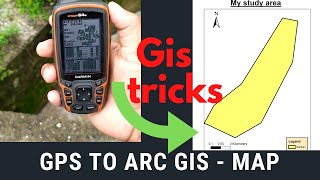
In this tutorial, we will guide you through the process of importing GPX (GPS eXchange) data into ArcGIS using the GPS Data AddOn for ArcMap. GPX files contain GPS data such as waypoints, tracks, and routes, making them valuable for various mapping and analysis tasks.
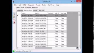
.gpx stand for GPS Exchange Format. GPS Exchange Format is an XML schema designed as a common GPS data format for software applications. It can be used to describe. Waypoints, tracks, and routes.
GPX files collect points in two ways: waypoints and tracks. Waypoints are generally single unrelated points while tracks make up a route or collection of related points with a start and endpoint. The type of point collected is specified in the Output Type field by the code WPT (waypoint) or TRKPT (track point.
If you like the Information that is given in this video so first hit the like button and share the video with your friends.
Keywords: GPX data, import GPX data in ArcGIS, GPS Data AddOn, ArcMap, GPS data visualization, spatial analysis, ArcGIS tutorial, mapping, GIS data, GPS eXchange
RS GIS HOME Facebook Page:
/ rsgishome
RS GIS HOME Facebook Groups:
/ geospatialcommunity
Join our Free Telegram Channel
Click here:https://t.me/rsgishome
Playlists:
Satellite Data Download:
• Satellite Data Download
Remote Sensing and GIS tutorial:
• Remote Sensing and GIS tutorial.
ArcGIS for beginners:
• Arcgis for beginners.
ArcGIS Model Builder:
• ArcGIS Model Builder
Excel to ArcMap:
• Excel to ArcMap
Google Earth Pro:
• Google Earth Pro
DGPS :
• DGPS
Geomatics Engineering Gate 2022 || Free Course:
• Geomatics Engineering Gate 2022 || Fr... .
___________________________________________________________________________________
About the Channel:
On this YouTube Channel:
Knowledge of Remote Sensing and GIS and how it works in the world
Videos and Lectures on Remote Sensing and GIS Techniques and their applications
A brief explanation of Practical Portion of GIS & Remote Sensing
Boost your concept with Remote Sensing and GIS
Keep yourself updated with the new techniques of Remote Sensing and GIS field
Onestop platform for Remote Sensing and GIS
So stay connected with us by just clicking on the Red Subscribe button and press the bell icon.
___________________________________________________________________________________
Follow us on:
Facebook Page: / rsgis
Follow me on Linkedin: / santanughosh7714b3141
Thank You.