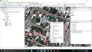
How To Show Multiple Label and Colorize Them in ArcMap

In this video I will show you Step by Step on How To Show Multiple Label and Colorize Them in ArcMap. How to Add new Line. Hope you will find this one helpful. #label #coloring_label #arcgis #multiple_label
******************************************************************
You can CHECK this OUT !!
BUY Domain at Cheap Price!! : https://cutt.ly/5CEuzSD
Buy gamming laptop at CHEAP Price from NewEGG!!!
Acer Nitro 5 ;15.6";GTX 1050 Ti @878$ :https://cutt.ly/f9rJKyc
Acer Nitro at 799$ : https://cutt.ly/H2iVO0P
Asus TUF A15 at 925$: https://cutt.ly/f2iVB2T
******************************************************************
Course with Certificate at $9 only!
MS Excel Online Training https://cutt.ly/uBx2Pc1
****************************************************************
Important Tutorials:
ArcGIS Geodatabase Design Basic File Geodatabase, Field, Subtype, Domain: https://cutt.ly/JYSmgQa
Free Spatial Data |Shapefile| of Any Country & Humanitarian Data: https://cutt.ly/1WawYD1
Land Cover Data 10 m Resolution: https://cutt.ly/3Waqcvo
Least Cost Path: https://cutt.ly/xWaqmEb
Download Open street Map: https://cutt.ly/SWaqWFk
Stream Power Index SPI Calculation:https://cutt.ly/jWaqT9t
Topographic Wetness Index TWI Calculation: https://cutt.ly/qWaqIw5
Suitability Analysis Using Arcgis: https://cutt.ly/6WaqSnA
Add xy data from excel, clip, select, split, table select tools in ArcGIS: https://cutt.ly/mWaqGuS
Drainage or Stream Frequency & Infiltration number: https://cutt.ly/7WaqJ5U
Calculate Stream or Drainage Density: https://cutt.ly/VWaqX36
Extracting Stream or Drainage Network from DEM: https://cutt.ly/QWaqMS9
Detail Watershed Delineation using DEM: https://cutt.ly/TWaq3Lk
ArcGIS Tutorial:https://cutt.ly/qWaq7gu
Qgis Tutorial: https://cutt.ly/ZWaq6e2
Change Detection: https://cutt.ly/sWawwfX
Download Free Shapefile:https://cutt.ly/XWawrsG
Download Soil Organic Carbon, Evapotranspiration, Land cover, Precipitation Data: https://cutt.ly/cWawtFC
Human Influence Calculation: https://cutt.ly/TWawuPv
Lineaments Extraction :https://cutt.ly/sWawi3K
World Soil Map Shapefile: https://cutt.ly/tWawaxY
Hotspot / Kernel Density Analysis: https://cutt.ly/nWawgLt
GIS Shapefile Data ( Road, Structure, etc.) for Any Country: https://cutt.ly/WWawjPq
Land Cover Change Detection: https://cutt.ly/cWawleE
Soil Moisture Index and Land Surface Temperature Calculation: https://cutt.ly/tWawzhs
Keyword: arcgis vbscript label expression new line, how to label polygons in arcgis, how to write label expression in arcgis, how to stack labels in arcmap, arcmap label classes, how to label a point in arcgis, arcgis label points, Label More Than One Field, Multiple Fields Labeling, Multi color labels, arcgis online label expression, rounding labels in arcgis, arcgis online label expression new line, how to label selected features in arcmap, arcgis pro label expression, arcgis label expression multiple fields, how to label features in arcmap, label expression arcgis online, how to label more than one field in arcgis
Contact if need
Facebook: / rsgistutorial
Twitter: / rsexplore
/ exploregisrstutorials89236a1b9