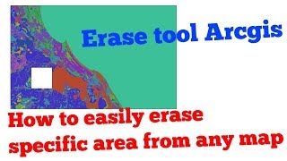
How to use Erase tool in ArcGIS || Measure Erosion Accretion

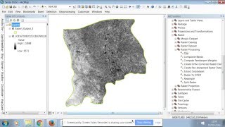
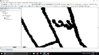
In this video I will show you how to use erase tool in ArcGIS and to measure erosion and accretion of land dynamics. Creates a feature class by overlaying the Input Features with the polygons of the Erase Features. Only those portions of the input features falling outside the erase features outside boundaries are copied to the output feature class. The Erase Features can be point, line, or polygon as long as the Input Feature is of the same or lesser order feature type. A polygon erase feature can be used to erase polygons, lines, or points from the input features; a line erase feature can be used to erase lines or points from the input features; a point erase feature can be used to erase points from the input features.
#SpatialAnalysis #Geoprocessing #GISTutorial #EraseFeature #ArcGIS #ArcMap #GIS #Erosion_Accretion
General Keywords:
salauddin rubel, salauddin gis, salauddin gis tutorial, gis tutorial, arcgis tutorial, arcmap tutorial,
arcmap tutorial for beginners, arcgis tutorial for beginners, gis tutorial for beginners, gis mapping tutorial,
gis software tutorial, geographic information systems, geographic information systems tutorial, arcgis, arcmap,
remote sensing, remote sensing tutorial, remote sensing and gis, mapping tutorial for beginners, mapping tutorial,
mapping for beginners, gis tutorial bangla, bangla gis tutorial, arcgis tutorial bangla, spatial analysis,
spatial analysis in arcgis, spatial analysis in gis, spatial analyst arcgis, spatial analysis tools in arcmap,
spatial analysis in arcmap, geoprocessing in arcgis, geoprocessing tools in arcgis, geoprocessing in arcmap,
geoprocessing in gis, raster processing arcgis, raster processing gis, raster processing arcmap, remote sensing image processing,
General Hash Tags:
#salauddin_rubel #salauddin_gis #salauddin_gis_tutorial #gis_tutorial #arcgis_tutorial #arcmap_tutorial
#arcmap_tutorial_beginners #arcgis_tutorial_beginners #gis_tutorial_beginners #gis_mapping_tutorial
#gis_software_tutorial #geographic_information_systems #geographic_information_systems_tutorial #arcgis #arcmap
#remote_sensing #remote_sensing_tutorial #remote_sensing_gis #mapping_tutorial_beginners #mapping_tutorial
#mapping_beginners #gis_tutorial_bangla #bangla_gis_tutorial #arcgis_tutorial_bangla #spatial_analysis
#spatial_analysis_arcgis #spatial_analysis_gis #spatial_analyst_arcgis #spatial_analysis_tools_arcmap
#spatial_analysis_arcmap #geoprocessing_arcgis #geoprocessing_tools_arcgis #geoprocessing_arcmap
#geoprocessing_gis #raster_processing_arcgis #raster_processing_gis #raster_processing_arcmap #remote_sensing_image_processing
"arc gis tutorial"
"arcgis 10 tutorial"
"arcgis 10.2 tutorial"
"arcgis online tutorial"
"arcgis tutorial"
"arcgis tutorial video"
"arcgis video tutorials"
"georeferenced maps"
"georeferenced pdf maps"
"georeferencing"
"georeferencing arcmap"
"georeferencing in gis"
"rms gis"
"tutorial ArcGIS"
"aerial remote sensing"
"arc gis course"
"arc gis program"
"arc gis training"
"ArcGIS"
"arcgis arcmap"
"arcgis online"
"arcmap"
"geography" earth
"geospacial"
"geospatial"
"geospatial systems"
"gis"
"gis online tutorial"
"gis software"
"opensource remote sensing software"
"remote"
"remote sensing meaning"
"remote sensing training"
"sensor"
"what is a remote sensing"
"what is remote sensing technology"
"whats remote sensing"
"geodata mapping"
"geographic information system definition"
"geographical data analysis"
"geospatial information systems"
"geoprocessing arcgis"
"gis data analysis"
"gis tools"
"hadoop arcgis"
"spatial analyst"
“arcgis arcmap”
“arcgis clip”
“arcgis data management tools”
“arcgis mosaic”
“arcgis spatial analyst”
“clip arcgis”
“clip raster arcgis”
“data clip”
“data management tools arcgis”
“raster”
“raster arcmap”
“raster data”
“raster image”