YouTube magic that brings views, likes and suibscribers

How to use GIS-based SWPT tool for Subwatershed Prioritization

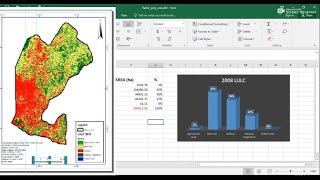
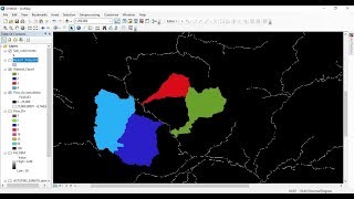
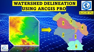
This video is to show you how to prioritize subwatersheds for conservation using the powerful GISbased SWPT (Subwatershed Prioritization Tool). In this informative video, you will explore how this automated GISbased tool helps you to identify and prioritize critical subwatersheds. The tool computes all subwatershed morphometric and other parameters at once.


Recommended