The easiest way to skyrocket your YouTube subscribers

Hydrologic Conditioning of DEMs Part 1: Overview

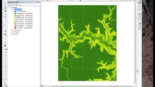
Exercise 2, Part 1 of 2, of the Hydrologic Applications module provides an overview of the steps required to hydrologically conditioning digital elevation models in ArcGIS.
This is part of the "Conservation Applications of LiDAR Data" series. Additional lectures, exercises and other training materials are at z.umn.edu/lidar.
Time points:1:00 getting started; overview of process: fill, flow direction, flow accumulation, reclassification, TPI. 7:20 Locating digital dams and other layers necessary for conditioning. 9:10 breaking digital dams. 10:15 data storage and environment settings. 11:45 Why conditioning is necessary.


Recommended