Ice Ages
Full text:
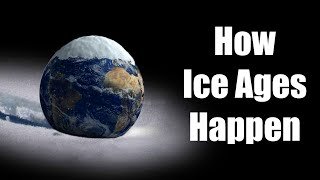
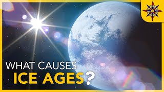
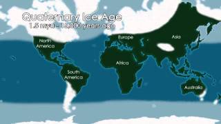
In this video, Ice ages are explained. These are cold periods in Earth's history, the last of which occurred about 12,000 years ago. Ice ages have played a major role in the formation of the landscape, including in Nordwest Europe.
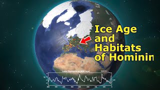
Let's start with the temperature changes from the last 400,000 years to the present. The line shows the temperature compared to the current temperature. Much of this line is below the current average temperature. That means that during this period it was on average much cooler than today, up to about 8 degrees cooler! These cold periods within ice ages are called glacial periods.
The warm periods are short periods of a predominantly cold period. Sometimes it was even a few degrees warmer than today! These warm periods are called interglacials. The secondlast ice age is called the Saale glaciation. The last ice age is called the Weichselian glaciation. Both periods have had a lot of influence on the formation of the landscape in NorthWest Europe.
The Saale glaciation, the secondlast ice age, occurred about 238,000 years ago to 126,000 years ago. Because it was very cold, on average about 6 to 8 degrees cooler than today, ice caps formed in mountainous areas, because it is colder there due to the altitude. Because this huge pack of snow and ice also reflected a lot of sunlight, it could remain cold on Earth. There was a lot of ice on the continents, so that the global sea level was tens of meters lower and shallow seas became dry, such as the North Sea.
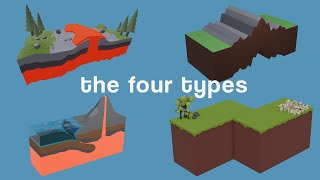
In Scandinavia too, more and more ice formed in the highlands, which did not melt due to the cold climate, but slowly moved to the rest of Europe and formed the landscape. A landscape shape formed by the ice is called a moraine.
Some material is deposited under the ice. This type of soil consists of an unsorted mixture of clay, sand and boulders is called boulder clay.
The moving ice has also pushed away part of the soil. Debris that is carried along by a glacier is accumulated, forming moraines. These hills are called push moraines.
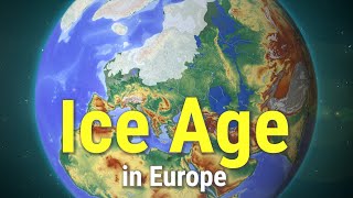
The land ice from Scandinavia slowly moved to the Netherlands, approximately to the Haarlem – Nijmegen line, pushing sediment upwards and creating push moraines at the end of the land ice. These push moraines are now known as the Utrecht Hill Ridge, the Veluwe and Salland Hill ridge national park.
Where the bottom was scraped away, a hollow is left behind by the ice mass. These deep parts are called tongue basins. Because they are formed by ice, they are also called glacial basins. There are a lot of tongue basins.
When stones fall unto the surface of glaciers, they are carried along by the ice and they are called glacial erratics. When the ice melted, the stones remained in the landscape, as in the Drenthe region. Because the land ice spread to the Haarlem – Nijmegen line, there are no boulders south of that line.
The Weichselian, the last ice age, lasted from 116,000 years ago to 12,000 years ago. Although there was again a lot of land ice all over the world, this land ice did not reach the Netherlands. However, it was on average much cooler in the Netherlands, so there was a Tundra. Only sporadically did the average temperature rise above freezing and the climate was generally arid. It was a polar desert.
From the North Sea area, which was dry, sand from the seabed was blown towards the Netherlands, creating a layer of sand in many areas. In Limburg, the smaller loess was deposited locally. The most important remnant in the landscape of the Weichselian is therefore the layer of sand.
In short: The last two ice ages have had major consequences for the landscape in NorthWest Europe