YouTube doesn't want you know this subscribers secret

Image Classification Map Tutorial - ArcGIS Pro

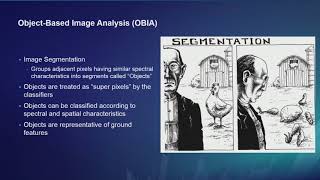
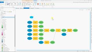
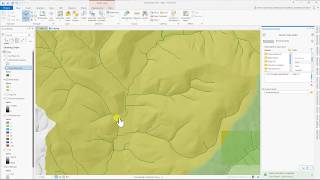
In this demonstration tutorial, we use the Classification Tools in ArcGIS Pro to perform a Maximum Likelihood spectral analysis of NAIP imagery. We go over defining training samples and classifying the land cover on a local golf course, in order to measure the acres of grass for a fertilizer treatment. The instructions are posted below and the data can be downloaded from the web. If you find this video helpful, please like it and subscribe. Thanks!
Instructions: https://drive.google.com/open?id=1nSI...


Recommended