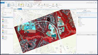
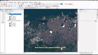
Image segmentation process in ArcGIS Pro

Welcome, everyone, to my channel dedicated to Space, Remote Sensing, and GIS. Today, we have an intriguing lecture in store for you, focusing on the fascinating topic of Image Segmentation.
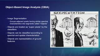
Segmented rasters play a pivotal role in the workflow of objectbased image classification. It's crucial to understand that poorly segmented rasters can significantly impact the accuracy of classification results. Image segmentation serves as a powerful tool to simplify and reduce variability by grouping nearby pixels into segments based on specific shape, spectral, and spatial characteristics. These segments can then be amalgamated into distinct classes, representing realworld features on the ground.
Throughout this lesson, you will gain valuable insights into the art of creating wellsegmented rasters, ultimately leading to cleaner and more precise image classification outcomes.