Secret sauce that brings YouTube followers, views, likes

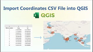
Importing CSV (Excel) Coordinates into QGIS

In this tutorial, we will show you how to import comma separated value (CSV) data which contains latitude & longitude into QGIS, how to plot the points on a map, and how to export the data into an ESRI Shapefile.
Download the data https://drive.google.com/drive/folder...


Recommended