Intersection of Shapefiles in ArcGIS

Intersection of Shapefiles in ArcGIS
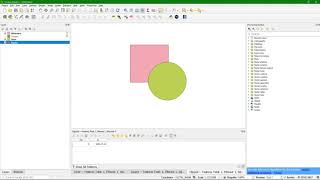
The Intersect tool creates a new coverage by overlaying the features from the input coverage and intersect polygon coverage. The output coverage contains the input features or portions of the input features that overlap features in the intersect coverage. The output features have the attribute from the original feature from the input coverage and the feature in the intersect coverage, which they intersect.
Intersect is one of several Overlay tools available. The tool most similar to Intersect is Clip, which does not transfer any attribute from the overlay feature class to the output.
Input Coverage features can be polygons, lines, or points. The intersect coverage must have polygon topology. Output coverage features resulting from the overlay are of the same type as the input coverage features. They are split when they intersect with the polygons of the intersect coverage. Topology is built for the output coverage.
Attribute tables are updated. The attribute table for the output coverage contains items from both the input and intersect coverage attribute tables. Items are merged using the old internal number of each feature. The two tables below list the items that are written to the attribute table of the output coverage.
#ArcGIS #ArcMap #Free_formation