Introducing ArcGIS GeoBIM

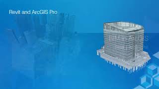
ArcGIS GeoBIM technology helps architects, engineers, construction teams and project owners design, build, and maintain smarter, sustainable infrastructure, cities, and communities for the future. A partnership between Esri and Autodesk, the mapbased technology allows a broader view of any project to be considered. The easytouse web platform lets users design Building Information Modeling projects in a geospatial context. With ArcGIS GeoBIM, you can integrate GIS locationbased technology and BIM data, linking maps, digital models, and project information in a single user experience. Keep your data organized, reduce file conversion time, and easily share information between teams and stakeholders when you use ArcGIS GeoBIM to put your projects on the map.
For more information, please visit: https://go.esri.com/geobim
Follow us on Social Media!
Twitter: / esri
Facebook: / esrigis
LinkedIn: / esri
Instagram: / esrigram
The Science of Where: http://www.esri.com