Introduction to Geographic Information Systems (GIS) Software: An Open Source Lecture

This video provides a tutorial of Geographic Information Systems (GIS) software. If you are new to GIS, this video will show what GIS is and what it can and cannot do.
Free and open source GIS software and data is used in the video.
This means you can start right away with using GIS without having to purchase software or find data.
Video Chapters:
0:00:00 Start
0:00:16 Introduction Video Topics Overview
0:01:36 Learning Objectives
0:02:36 What is GIS?
0:03:22 Parts of GIS
0:05:07 Organizing the World Geographically: Map Layers
0:05:07 What Can You Do (and Not Do) with GIS Software?
0:05:07 Data and Spatial Asset Management
0:08:54 Storage Formats
0:10:15 Storage Formats Shapefiles
0:11:22 Imagery
0:12:16 Relational Databases
0:13:06 Data Querying
0:13:55 Spatial Query
0:14:21 Table Joining
0:14:57 Spatial Analysis
0:15:44 GIS Programming JavaScript
0:17:21 GIS Programming Python
0:17:44 GIS Programming Data Science
0:18:20 Modeling – “What If?” Scenarios
0:18:51 Modeling – Transportation
0:19:21 Cartography and Map Production
0:20:26 Time and Animation
0:21:12 3D and Animation
0:21:59 Mobile GIS and Field Data Collection
0:22:46 Mobile GIS and Field Data Collection: Drones
0:23:19 GIS Limitations
0:25:38 GIS Demonstration Introduction
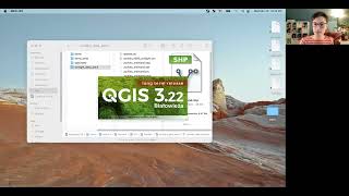
0:26:05 GIS Demonstration QGIS Overview
0:26:37 GIS Demonstration Basemaps and Open Street Map (OSM)
0:27:23 GIS Demonstration Plugins
0:28:16 GIS Demonstration Basic QGIS Use
0:28:54 GIS Demonstration Adding Data to a QGIS Map (Mumbai India Datasets)
0:31:57 GIS Demonstration Change Layer Symbology
0:34:00 GIS Demonstration Toggle Layer Visibility
0:35:15 GIS Demonstration Attribute Tables
0:36:12 GIS Demonstration Attributes and Layer Symbology
0:37:16 GIS Demonstration Attribute Tables and Query
0:39:20 GIS Demonstration Raster Datasets
0:41:27 GIS Demonstration Modifying Landsat Imagery Bands
0:43:37 GIS Demonstration Measure Tool
0:44:05 GIS Demonstration Importing Text Files
0:48:52 Video Summary
Follow these links to access to the software and data sets used in the video.
Software:
QGIS – The free and open source GIS software used in the video:
https://www.qgis.org
Data:
The Mumbai India datasets – The data sets used in the video, available for free to download:
http://gisfordisastermanagement.com/#...
Topics discussed in the video include spatial data and asset management, imagery and remote sensing data querying and table joining, spatial analysis, GIS programming and application programming interfaces (APIs), spatial modeling, cartography, visualization, and map production, animation and 3D, mobile GIS and field data collection, and limitations of GIS.
A demonstration of GIS software is also provided to show you what GIS software looks like in practice.
If you liked this and other videos on the geographic information science channel, please like these videos, leave comments, or subscribe to this channel so you can stay informed of new videos.
Subscribe to this channel:
https://www.youtube.com/user/GIScienc...
Also, feel free to contact me if you have any questions, I love hearing from the YouTube community.
Thanks for stopping by!
Brian Tomaszewski, Ph.D.
@bangeobrian
[email protected]