Land Surface Temperature | Calculate LST in QGIS

Land Surface Temperature | Calculate LST in QGIS
About this Video
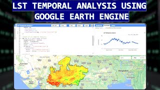
Welcome to our YouTube channel! In this video, we dive into the fascinating world of Land Surface Temperature (LST) and show you how to calculate it from Landsat 8 satellite images using QGIS, a popular Geographic Information System (GIS) software.
Land Surface Temperature (LST) is a crucial parameter for various environmental and scientific studies, including climate change monitoring, urban heat island analysis, and agriculture. It represents the temperature of the Earth's surface as measured by remote sensing satellites like Landsat 8.
By the end of this video, you'll have a comprehensive understanding of Land Surface Temperature and the skills to calculate it from Landsat 8 satellite images in QGIS, empowering you to conduct your own geospatial analyses.
Don't forget to like this video, subscribe to our channel, and hit the notification bell to stay updated with our latest tutorials on GIS, remote sensing, and environmental science. If you have any questions or suggestions for future videos, please leave them in the comments section below.
Thank you for watching, and let's get started with Land Surface Temperature analysis!
Chapters
00:00 Recap
00:18 Intro
00:24 Steps
00:29 Calculate LST in QGIS
08:11 Outro
#qgis #dawnofgeospatialworld #gis #remotesensing #satelliteimagery #temperature #lst #landsat #surface_temperature #climatechange #climate #weather #tutorial
Playlists ⬇
1⃣ Various Space Agencies & Missions: https://bit.ly/44UBJQI
2⃣ Data Download Processes for GIS Work: https://bit.ly/44WYP9D
3⃣ QGIS Basics Tutorials: https://bit.ly/3Oljo95
4⃣ ArcMap Basics Tutorials: https://bit.ly/3DoAopy
5⃣ Terrain Analysis: https://bit.ly/44UBJ38
6⃣ Hydrological Analysis: https://bit.ly/472LGgY
7⃣ Image Classification: https://bit.ly/3sb1iyR
8⃣ Indices: https://bit.ly/3RfKPUB
The following geospatial and environmental solutions video instruction is available on this channel:
ArcGIS, QGIS (Geospatial Analysis, Monitoring)
Cartography
Basics of Mapmaking
Basics of GIS & Remote Sensing
You can watch our videos on YouTube : @dawnofgeospatialworld
If you think they're useful, kindly subscribe to our channel.
Instagram : / dogw_official
Facebook Group : / 1044628716532282
Thank you So Much.....