15 YouTube views, likes subscribers in 10 minutes. Free!

Land Surface Temperature (LST) || ArcGIS and Landsat 8

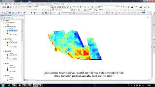
Land Surface Temperature (LST) measures how hot the land is. In this video we will use Landsat 8 imagery from USGS and calculate the LST.
Link to PDF: https://asset.cloudinary.com/dgkommeq...


Recommended