15 Free YouTube subscribers for your channel

Land Surface Temperature (LST) Data Extraction From Sentinel-3 SLSTR Level 2 Data using ESA SNAP

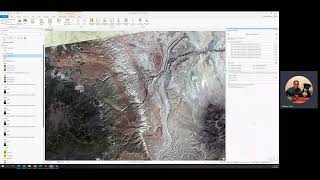
How to extract Land Surface Temperature ( LST ) data from Sentinel3 SLSRT Level 2 data using ESA SNAP and ArcGIS. If you dont have ArcGIS Software, you can use Free and Open Source QGIS Software available from www.qgis.org.
Music by : www.bensound.com


Recommended