15 Free YouTube subscribers for your channel

LiDAR Exporting and Sharing in Global Mapper
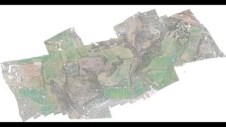
In the eighth and final webcast in the LiDAR Processing series, we demonstrate several options for sharing point cloud data from Global Mapper. We show how to capture a static 3D view of the point cloud and how to create and record a 3D flythrough video. We will show the options for exporting edited LiDAR in the standard LAS and LAZ formats and will walk through the steps for creating a 3D PDF, which can be displayed in Adobe Acrobat Reader.
If you have questions about any of the workflows or topics covered in this presentation, email: [email protected].
For licensing or sales questions, email [email protected].
To download an evaluation copy of Global Mapper, visit: www.bluemarblegeo.com/products/globalmapper.php


Recommended