A little secret to rock your YouTube subscribers

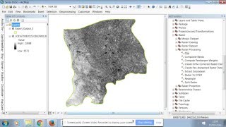
LST Estimate in ArcGIS Pt 1 Convert Digital Numbers DN to Top of Atmospheric Spectral Radiance (TOA)

this video will help you to learn how to convert the digital number DN of landsat8 to top of atmospheric spectral radiance a step to estimating land surface temperature
#gis #remotesensing #weather #temperature


Recommended