Make an Open-Source Web Map with QGIS

Learn how to create a free, interactive web map using the opensource mapping software, QGIS, and the QGIS2Web plugin. After designing a map and generating the web map files, the workshop shows how to deposit the files in a GitHub repo and publish the web map to a live URL that you can share. A sample dataset showing sunset times across the U.S. can be used with the exercise tutorial. View the workshop materials on GitHub: https://umassgis.github.io/workshops...
Introduction
2:01 Workshop overview
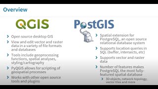
Setting up the map in QGIS
3:10 Static vs. web maps
8:46 Exercise overview
10:10 What's in the sample dataset
12:29 Opening QGIS / adding data and basemaps
15:53 Changing the project's Coordinate Reference System
17:22 Organizing project files
18:24 Exploring the attribute table
20:55 Symbology (categorized)
24:55 Symbology (two variables)
28:22 Symbology (graduated)
Using the QGIS2Web plugin
34:03 Overview
36:40 Setting up the project for export
45:04 Plugin's layers and groups tab (layer visibility, popups)
49:07 Plugin's appearance tab (abstract, widgets, default extent)
56:06 Plugin's layer visibility tab
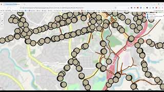
56:50 Exporting the web map files
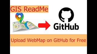
Publishing the map in GitHub
1:00:54 Overview
1:02:14 Logging in to GitHub / creating a new repo
1:06:04 Editing the ReadMe file
1:09:10 Uploading the web map files
1:13:34 Publishing the web map with GitHub Pages
Random hot tips
27:58 Renaming a layer
33:08 Making a copy of a layer
43:12 Applying symbology from one layer to another
Recording from the workshop "Make an OpenSource Web Map with QGIS" by Dr. Becky Seifried, Geospatial Information Librarian, UMass Amherst Libraries.