Mapping Easements

In this workshop, we examined the various techniques for mapping easement rights in ArcGIS Pro, both simple features and the Parcel Fabric. We looked at simple strip easements, and easements in subdivisions and explored the tools used to construct them. Since we demonstrated both simple features and the Parcel Fabric, you could compare the efforts to construct and the resulting data to help you understand the differences. Click on the links below to review a specific topic.
00:00 Intro
01:45 What is an Easement?
03:15 Ways that Easements are Described
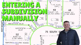
06:15 Demonstrations
08:00 Simple Centerline Easement
09:00 Copy Parallels
10:15 Building the Closing Lines
11:00 Extending and Shortening the sides to the property Lines
11:30 Extend and Trim Tool
13:00 Line Intersect Tool
15:00 Creating the Easement Polygon with Trace
15:30 Using the Construct Polygon Tool
17:30 Creating the Easement Polygon with the Trace Tool
20:15 Using the Reshape Tool
21:00 Using the Trace Option instead of Copy Parallel
27:00 Creating Aliquot Easements using the Divide Tool
35:15 Creating an Easement in the Parcel Fabric
36:00 Using a Connection Line for Reference Line
39:00 Creating a Seed and Building the Polygon
40:00 Checking all Features in the Easement
42:30 Building Aliquot in the Parcel Fabric