Master Google Earth Engine: Remote Sensing Analysis Online Training | New Batch Starts July 19th

These online live training classes will teach you all the necessary things to start using GEE for your remote sensing analysis. We mainly focus on those people who don't know any programming language or Earth Engine function. We cover LULC mapping, change detection Analysis, Air Quality Monitoring, Monitoring Particulate Matter (PM2.5), Evapotranspiration, Water logging, Urban Heat Island (UHI), UFTVI, Urban growth monitoring, Urban spawral, Time series analysis, calculating any Indices, Supervised Classification, Unsupervised Classification, Machine Learning Methods, NDVI change detection, Hyperparameters Tunning, Improving the accuracy, Practical project on GEE and more.
#registrationopen for a new batch of 7 days of Complete online live training on #googleearthengine for #remotesensing & #gis Analysis for Beginners to Advanced level for noncoders without any programming language knowledge. Brush up your knowledge and learn the new advanced geospatial technology.
Class Start: 19th July, 2024
Admission Last Date: 18th July, (1st 10 registered people get 50% discount).
For registration contact this WhatsApp number: +8801780942798 or email: [email protected]
Total Class: 7 days (Friday and Saturday in Week)
Class Duration: 4 hours (Each day)
Time: 9:00 P.M (GMT +6)
Training language: English
For more details visit our website: https://www.studyhacksgeospatial.com/...
Course Content:
1st day:
Introduction to GES
How to use GEE JavaScript and Python API
Learn the basic principles of JavaScript syntax and Python.
How to create the IDE for Google Earth Engine python API.
Client vs. Server object on GEE
How you get the server to execute your code?
Importing Raster and Vector Data: Local storage & GEE Dataset
Filtering Attribute Table from shapefile or Geodatabase
2nd day:
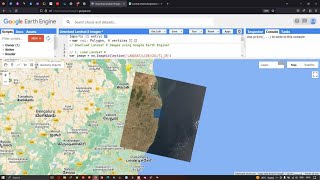
Filtering and Displaying Satellite Images: Landsat, Sentinel, Modis
How to merge Landsat5 , Landsat7, Landsat8 and Landsat9 and make the annual Image collection
Single date Satellite Images
Satellite Composite: Mosaic, Median, Mean
Band combinations
Export Satellite Imagery: Landsat , Sentinel and Modis
Import, Filter, Reduce, Clip and display Raster data in GEE
Time series Chart of NDVI using GEE readymade dataset
Export Any Shapefile
3rd day:
Calculating Any Indices from Satellite Images using Landsat and Sentinel
Filtering and Displaying Satellite Images: Sentinel2 and Monitoring NDWI , NDVI and Time series chart of NDWI and NDVI
Flood Mapping using OTSU.
Extract water body using Thresholding and calculate the water surface area.
NDVI , NDWI , SAVI and all indices Time series Chart using Landsat and Sentinel
Export Any Shapefile from GEE
How to add Gradient Legend and Title on GEE
NDWI Calculated from Modis and Landsat data
4th day:
How to remove cloud and Haze from satellite imagery Landsat and Sentinel
Visualization (DEM) of Hill shade and Slope Map in GEE using NASA SRTM and Aster
Land surface temperature (LST) Monitoring from Landsat satellite imagery and Modis
Urban Heat Island (UHI) and UFTVI Monitoring using GEE.
How to calculate Average, Maximum, Minimum NDVI any specific region.
GEE: How to make monthly Evapotranspiration.
5th day:
Air Quality Monitoring: all parameters
Particulate matter 2.5 or PM2.5 monitoring and time series chart.
How to Download Air Quality parameters Time series data in CSV format using GEE.
Air Quality Monitoring Time Series chart
Air Quality Monitoring: How to calculate total emission of nitrogenoxide or any gases in GEE using sentinel5
ArcMap software: How to make research paper map using GEE & ArcMap software.
6th day:
Introduction to Machine Learning in GEE
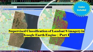
How to make LULC Map using Machine Learning: Supervised and Unsupervised algorithm
Random forest, CART, SVM, Minimum distance classifier to make LULC
How to Check LULC accuracy assessment using GEE. (Kappa, Producers & Consumers accuracy)
Calculate LULC classes Area
How to add Legend in LULC Map
How to Export LULC and make research paper LULC map using ArcMap
7th day:
LandUse and LandCover Change Detection using GEE
NDVI change detection using Google Earth Engine
NDVI Classification using GEE
Extract the dense Vegetation using GEE and Calculate the area
Classwise LULC change detection in ONE layer using GEE
Hyper parameter Tuning for improving the accuracy of your machine learning model
Join the Telegram group: https://t.me/gisandremotesenginglearn...
Follow our official YouTube channel: / @gisrsinstitute
Follow our Instagram: / study_hacks_geoscience_world
Follow our Twitter: / gisrsstudyhacksa
Join our Telegram Group: https://t.me/gisandremotesenginglearn...
Follow our Facebook page: / gisrsinstitute
#googleearthengine #remotesensing


![The moment we stopped understanding AI [AlexNet]](https://i.ytimg.com/vi/UZDiGooFs54/mqdefault.jpg)