How to get free YouTube subscribers, likes and views?

mosaic raster file :how to merge raster data: merge dem data
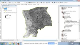
Mosaic Raster is a way to merge the raster data into one file so that working can be done in one file. Merging dataset is an important option in ArcGis.
combine raster data is a head ace if you actually dont know. Merging solves all the problems .
catchment area calculation • Catchment area Calculation using arcg...
catchment above certain specifies elevation • Catchment area above specified elevat...
download high resolution geo referenced image • Download High resolution Geo Referenc...
facebook https://www.facebook.com/hydropowerin...
~~~~~~~~~
Please watch: "नेपाल को गौरव कालिगण्डकी हाइड्रो kali gandaki hydropower A brief introduction"
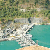
• Kaligandaki "A" Hydropower
~~~~~~~~~


Recommended